When hurricane forecasters released their seasonal outlooks in spring 2026, predictions called for above-normal activity in the northeastern and central Pacific basins but below-normal activity in the Atlantic. By early September, near the climatological peak of hurricane season, those predictions had held: the eastern Pacific was producing storms at well above normal rates while the Atlantic remained notably quiet.
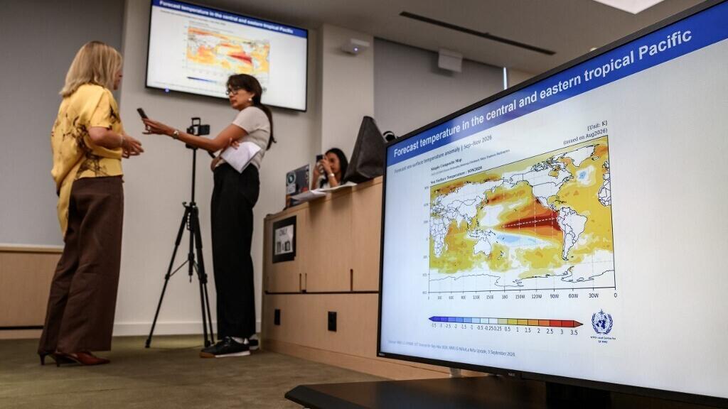
El Niño, a warming of ocean temperatures across the central and eastern Pacific, typically enhances hurricane activity in the eastern and central Pacific basins. The pattern shifts large-scale atmospheric circulation in a way that suppresses hurricane activity in the Atlantic by increasing wind shear, conditions that make it harder for storms to develop and sustain themselves.
As of September 3, the Northeast Pacific had produced 15 named storms and six hurricanes, well above normal for that point in the season. The Atlantic basin, meanwhile, had produced just five named storms and no hurricanes. Accumulated cyclone energy, an index that measures both the intensity and duration of storms, stood at 130 in the Northeast Pacific, about 50 percent above normal, compared with 4.4 in the Atlantic, about 9 percent of normal for the date.
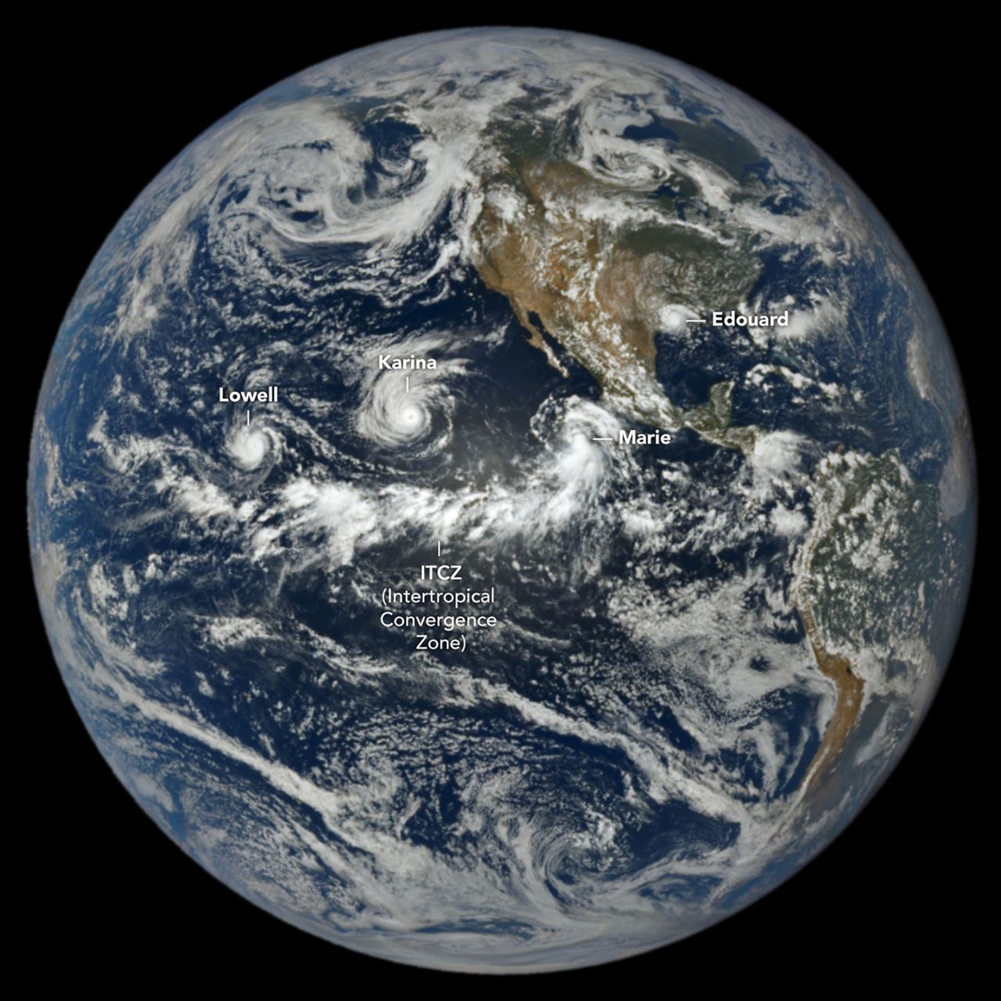
At 1:14 p.m. Pacific Daylight Time on September 1, NASA's Earth Polychromatic Imaging Camera on the Deep Space Climate Observatory satellite captured an image of three tropical cyclones churning in the Pacific simultaneously. The storms were identified as Lowell, Karina, and Marie, spinning several thousand kilometers apart across the basin.
Lowell became the strongest of the three, reaching Category 5 strength for several hours on September 2 with winds at that level. Around the same time, Karina, spinning to the east, achieved Category 4 strength, a rare instance of Category 4 and 5 hurricanes occurring simultaneously in the region. Marie, located southwest of Baja California, was still a tropical storm when the satellite image was acquired but was strengthening as it moved northwest.
In the Atlantic, Tropical Storm Edouard was visible in the same image over Louisiana and Texas shortly after landfall. The National Weather Service reported that it brought torrential rains and strong winds that downed trees and power lines, with some areas receiving 15 to 24 inches of rain.